Saturday, June 16, 2007

Santa Fe Tornado Debriefing


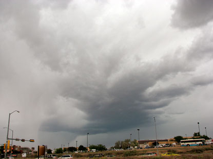
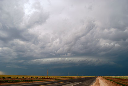
The first week of June brought severe weather to Santa Fe. This updraft was severe warned for hail, but didn't drop much in town. However, it did rain quite a bit.


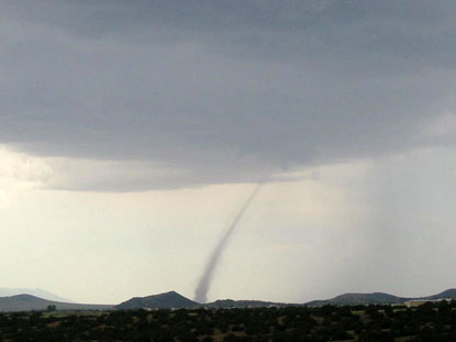
5 days later, on Saturday, June 9, I was readying to go chase a cell that was rapidly forming over Cochiti Pueblo. I looked out the window to note progress and was utterly shocked to see this landspout at La Bajada hill south of town. My gear was already in the truck, and by the time I moved to record the event it was over. This photo was taken by Peter Breslin.


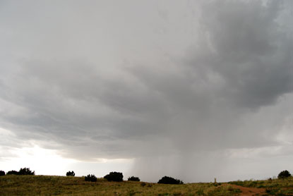
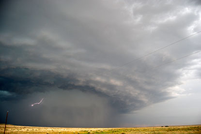
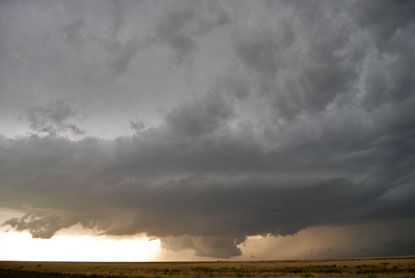
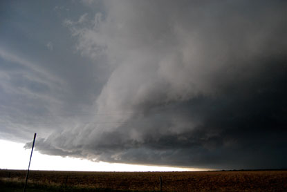
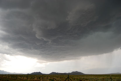
I jumped in the truck and rushed to the storm. I got under the updraft about 20 minutes after it had sucked up and transported the landspout. There was a nice rain-free base, but it was high at over 12,000 ft., making it less likely a tornado producer.


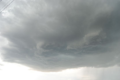
But the updraft did put on a bit of a show. I'm not sure if this qualifies as a wall cloud, but it was unusual for an updraft in Santa Fe County.


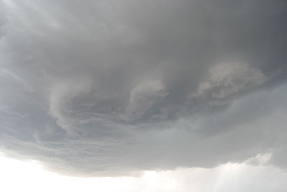
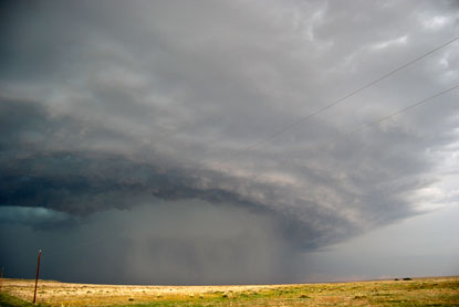
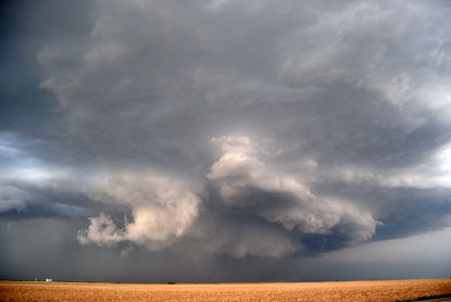
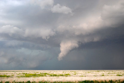
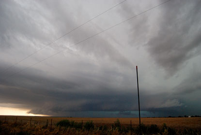
Here it looks like three separate wall clouds.


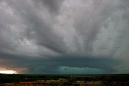
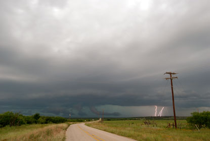
I'm inclined to believe this storm had some rotation when I was taking these pictures. But it went linear as it crashed into the Sangre de Christos, ending Santa Fe's big day in Tornado Alley.

Tuesday, June 12, 2007

Chase 5: Scared Straight


I got a headstart on my chase on Thursday, May 31. With my nowcaster Bob Schaefer's help, I arrived in Boise City, OK right when when things were really firing. As I approached this storm from the south, its structure resolved itself and I knew I had a winner.


This was my first HP supercell.


Another shot without the spark.


Meanwhile, Bob told me that the velocity couplet was looking rather severe. I moved back south and east, easily following the storm along highway 412. It began throwing down these insane wallclouds with lots of scary-looking rotation. The storm was moving WSW, the same direction as the road, so I was safe where I was at, pretty much by myself as most of the other chasers were coming up from Guymon, OK to the east.


But when this funnel began to form, I really started to get nervous. It would have been an awesome photographic opportunity had it become a tornado.


Soon there were other chasers on the road, like over a hundred of them. I figure this must be some university meteorology research project in action.


The storm to the west took on the appearance of a serious groundscraper.


My first DOW truck sighting. I decided to follow it toward Guymon. There we came upon another DOW truck and a billion other chasers. When the DOW truck pulled over, so did I. This is the result:


Friday's chase took me from Guymon, OK, to Madador, TX, and points southeast. There I finally managed to get in front of this monster storm, which was backbuilding faster than I could drive on 70 m.p.h. roads. It sucked in just about everything in the sky within a 100 mile radius.


This storm made yesterday's Guymon storm look positively puny in comparison.


The green maw of hailacious fury. I stopped on the way to Throckmorton, TX, to get this shot. The delay meant driving directly under the wall cloud to get in front of the storm again. Yet another moment of fear realized on this chase.


I stopped to kick back after the thrilling chase. No tornado today, but lots of adrenaline and lots of driving to get back home. Total chase mileage: 1,420 miles.

Labels: