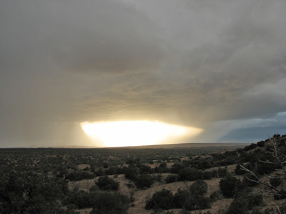
It's Always the Same
09/21/2006 @ 6:44:13 - 7:58:17 PM MDT
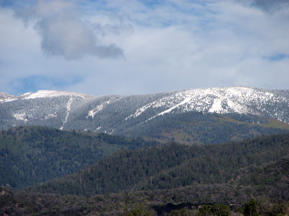
Every day, the sun sets over the Jemez.
posted by guruphiliac @ 8:41 PM
0 comments
![]()
posted by guruphiliac @ 8:41 PM
0 comments
![]()
posted by guruphiliac @ 3:31 PM
0 comments
![]()
posted by guruphiliac @ 9:30 PM
0 comments
![]()
I've recently met a young meteorologist online who is happy to answer my questions about how the atmosphere works. Today she gave a quick online seminar about theta-e ridges:
Theta-e is also called potential temperature. Essentially it means if you squeezed all the moisture out of the air, (as a result you would gain latent heat energy), what would the new temperature be. If you have two air masses that are the same temperature, the one with more humidity would therefore have a higher potential temperature. Technical version here: On a skew-T log-P find the LCL and follow the moist adiabat up until the dry and moist adiabat lines are running parallel then follow the dry adiabat back down to the 1000mb line.
Theta-e maps serve two purposes. First, we can compare air masses that may be at different sea-levels. Temperatures at sea-level are obviously going to be warmer than temperatures in Denver, a mile higher. So you drop Denver down to the same level [where] you're comparing apples to apples.
The second purpose of a theta-e chart would be to show warm air advection (WAA) and cold air advection (CAA). Assuming no outside force (convection, frontal passage, etc) a parcel of air will actually follow its theta-e boundaries because essentially, theta-e is density. A less dense parcel will ride up over a more dense parcel (warm air over cold air).
So why are theta-e ridges important? Because when combined with confluence and difluence they show you where you're going to get serious convection...ie: tornadoes, snow storms, etc.
posted by guruphiliac @ 10:45 PM
0 comments
![]()
posted by guruphiliac @ 9:48 PM
0 comments
![]()
posted by guruphiliac @ 7:56 PM
0 comments
![]()
posted by guruphiliac @ 10:20 PM
0 comments
![]()
posted by guruphiliac @ 8:03 PM
0 comments
![]()


![]()