Mushroom Clouds
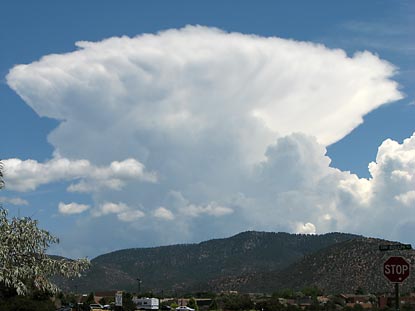
07/26/2006 @ 01:02:15 PM MDT
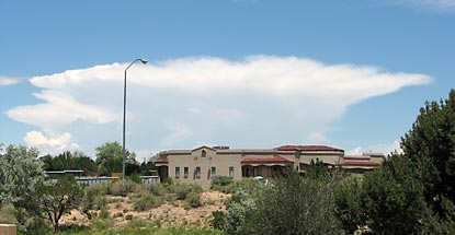
07/26/2006 @ 01:02:32 PM MDT
 Light winds aloft and steep lapse rates caused by cold air aloft capped by a warm inversion layer join forces to create some spectacular cumulonimbi around Santa Fe.
posted by guruphiliac @ 12:29 PM
0 comments
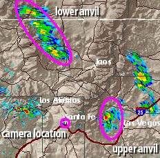
![]()
 This convection moved west along the north side of Interstate 40 between Clines Corner and Albuquerque between 6 and 8 tonight. It was moving in the blind spot of
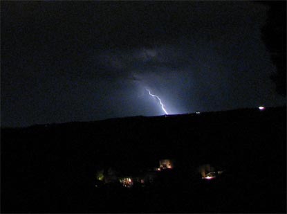
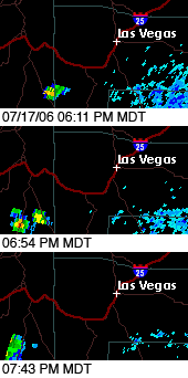
 This lightning occurred about 40 miles due south from my location in this cropped photograph. I used a 5-second exposure, ƒ-stop 2.7 and ISO 200 on my Canon S3 IS.